Corinna Katzler
Ich konnte die Möglichkeit eines Auslandpraktikums bei der Kantonspolizei Zürich in der Schweiz nutzen.
Die Geoinformation in Kombination mit modernen Technologien und ihren Kernthemen digitale Erfassung, Analyse, Verarbeitung, Bereitstellung und Darstellung geografischer Phänomene und räumlicher Zusammenhänge liefert Lösungen zum besseren Verständnis unserer Umwelt.
Geoinformationen sind ein Schlüssel für die gesellschaftlichen & wirtschaftlichen Herausforderungen dieses Jahrhunderts. Hoch relevante Themengebiete sind z.B. Klima- und Umweltschutz, Naturkatastrophen, Routen- und Einsatzplanung, Klimawandel und Umweltbelastungen, Nachhaltigkeit, Schutz ökologisch wertvoller Räume und Smarte Umwelt.
Neben Basiswissen in Informatik und Mathematik liegt der Fokus der Ausbildung auf Geoinformation und deren Einsatz in Umwelfragestellungen, z.B.
Für deren Bearbeitung braucht es neben Problemlösungskompetenzen, interdisziplinärem Denken und Arbeiten sowie technologischem Know-how folgende Fähigkeiten:
Bei Fragen zum Studium kontaktieren Sie:


HTL-Absolvent*innen können ihr IT Bachelor-Studium um bis zu einem Jahr verkürzen, wenn ausgewählte Einstiegsprüfungen vor Studienbeginn absolviert wurden und eine facheinschlägige HTL absolviert wurde. Zugangsvoraussetzung für den Einstieg ins 2. oder 3. Semester ist ein Notenschnitt von 2 oder besser in den letzten zwei Jahreszeugnissen (4. und 5. Klasse) der HTL.
Ein Einstieg ins 2. Semester ist nach Prüfen der Unterlagen individuell möglich.

Mit über 80 Study & Work Partnerunternehmen bietet die FH Kärnten Studierenden an, Studium & Beruf zu vereinbaren!
Empfehlungen seitens der Hochschule, um Studium & Arbeit möglichst optimal zu kombinieren.
Study & Work ist ein einzigartiges Jobservice der FH Kärnten. Studierende haben durch dieses attraktive Angebot die Chance, theoretisches Wissen umgehend in die Praxis umzusetzen und berufliche Erfahrungen während des Studiums zu sammeln. Das Angebot gilt exklusiv für Studierende der FH Kärnten. Die Bewerbungsphase startet jedes Jahr im Wintersemester vom 1. bis 20.10.
Beschäftigungsausmaß: geringfügig bis zu 8 h / Woche möglich
Stundenplan: einige Studiengänge sind so organisiert, dass der Montag LV frei ist
Beschäftigungsausmaß: in Teilzeit bis max. 20 h / Woche möglich
Stundenplan ist berufsfreundlich organisiert (Vorlesungen am Tagesende, Wochenende, geblockt oder auch online)

Der Bachelorstudienzweig "IT-Geoinformation und Umwelt" widmet sich den Grundlagen von Geografischen Informationssystemen (GIS) und ihren Anwendungsgebieten in Technik, Ökologie und Wirtschaft. Studierende erhalten einen umfassenden Einblick in die Geoinformationswissenschaften und lernen, wie sie in vielfältiger Weise in der Praxis angewendet werden. Das Studium ist von Interdisziplinarität, Internationalität und einem stark praktisch orientierten Zugang geprägt.
Von Umweltanwendungen über die raumbezogene Entscheidungsunterstützung bis hin zum Risikomanagement ergeben sich weitläufige Einsatzgebiete in der Geoinformation. Im Laufe des Studiums befassen sich Studierende auch mit dem Design und der Entwicklung von GI-Systemen und -Applikationen (z.B. WebGIS, Geo-Apps), der Analytik, der Räumlichen Analyse und der Statistik, sowie mit Datenmodellierung, Geodatenbanken und mit Visualisierung. All diese Felder tragen aus unterschiedlichen Perspektiven vor allem zu einem bei: zu einem besseren Verständnis unserer Umwelt.
Was Studierende des Studienzweigs "IT-Geoinformation und Umwelt" ins Studium mitbringen sollten:
Konkrete Vorkenntnisse sind für das Bachelorstudium "IT-Geoinfomation und Umwelt" nicht notwendig. Daher können Schülerinnen und Schüler aus allen Schulformen nach der Matura mit diesem Studiengang beginnen, wenn sie das entsprechende Interesse und die Bereitschaft zur Leistung mitbringen. Um den Studienstart zu erleichtern, bietet die FH Kärnten Intensivkurse in Mathematik, Informatik und Physik an. Fehlende Hochschulreife kann durch einschlägige berufliche Qualifikation und Besuch des Vorstudienlehrgangs ausgeglichen werden.
Nach erfolgreichem Abschluss des Studiums "IT-Geoinformation & Umwelt" verfügen AbsolventInnen über folgende Fähigkeiten und Kenntnisse:
| Lehrveranstaltung | Typ | SWS | ECTS-Credits | LV-Nummer |
|---|---|---|---|---|
| Angewandte Mathematik 1 | ILV | 4,0 | 5,0 | B2.08510.10.010 |
| Coding Essentials | ILV | 3,5 | 5,0 | B2.08510.10.012 |
| Elektronische und Physikalische Grundlagen Gruppe 1 | ILV | 4,0 | 5,0 | B2.08510.10.013 |
| Elektronische und Physikalische Grundlagen Gruppe 2 | ILV | 4,0 | 5,0 | B2.08510.10.013 |
| Introduction to Computing | ILV | 3,5 | 5,0 | B2.08510.10.014 |
| Web Technologien | ILV | 3,5 | 5,0 | B2.08510.10.011 |
| Studienzweig: Medizintechnik | Typ | SWS | ECTS-Credits | LV-Nummer |
| Team- & Projekt Management | ILV | 2,5 | 5,0 | B2.08512.10.010 |
| Studienzweig: Multimediatechnik | Typ | SWS | ECTS-Credits | LV-Nummer |
| Team Building und visuelle Kommunikation | ILV | 2,5 | 5,0 | B2.08511.10.010 |
| Studienzweig: Netzwerk- und Kommunikationstechnik | Typ | SWS | ECTS-Credits | LV-Nummer |
| Team- & Projekt Management | ILV | 2,5 | 5,0 | B2.08513.10.010 |
| Lehrveranstaltung | Typ | SWS | ECTS-Credits | LV-Nummer |
|---|---|---|---|---|
| Architekturen mobiler Geräte 1 | ILV | 2,0 | 2,5 | B2.08510.30.015 |
| Datenmanagement | ILV | 2,0 | 2,0 | B2.08510.30.020 |
| Einführung in die künstliche Intelligenz | ILV | 2,0 | 3,0 | B2.08510.30.021 |
| English 2 - Technical English and Business Communication Gruppe 1 | SE | 2,0 | 2,0 | B2.08510.30.010 |
| English 2 - Technical English and Business Communication Gruppe 2 | SE | 2,0 | 2,0 | B2.08510.30.010 |
| Entwicklung mobiler Anwendungen 1 | ILV | 2,0 | 2,5 | B2.08510.30.016 |
| IoT - Grundlagen | ILV | 2,0 | 2,5 | B2.08510.30.030 |
| IoT - Standards und Protokolle 1 | ILV | 2,0 | 2,5 | B2.08510.30.031 |
| Software Engineering 1 Gruppe 1 | ILV | 2,0 | 2,0 | B2.08510.30.013 |
| Software Engineering 1 Gruppe 2 | ILV | 2,0 | 2,0 | B2.08510.30.013 |
| Statistik und Wahrscheinlichkeitstheorie | ILV | 2,0 | 2,0 | B2.08510.30.012 |
| Web Programmierung Gruppe 1 | ILV | 3,0 | 5,0 | B2.08510.30.011 |
| Web Programmierung Gruppe 2 | ILV | 3,0 | 5,0 | B2.08510.30.011 |
| Studienzweig: Medizintechnik | Typ | SWS | ECTS-Credits | LV-Nummer |
| Grundlagen der Biosensorik und Messtechnik | ILV | 3,5 | 5,0 | B2.08512.30.011 |
| Medizinische Signalverarbeitung | ILV | 3,5 | 4,0 | B2.08512.30.012 |
| Schnittstellen in der Medizin | ILV | 3,5 | 5,0 | B2.08512.30.010 |
| Studienzweig: Multimediatechnik | Typ | SWS | ECTS-Credits | LV-Nummer |
| 3D Grafik-Engines | ILV | 4,0 | 5,0 | B2.08511.30.011 |
| 3D Modellierung | ILV | 3,5 | 5,0 | B2.08511.30.010 |
| Einführung in Virtual und Augmented Reality | ILV | 3,0 | 4,0 | B2.08511.30.012 |
| Studienzweig: Netzwerk- und Kommunikationstechnik | Typ | SWS | ECTS-Credits | LV-Nummer |
| Mikrocontroller | ILV | 4,0 | 6,0 | B2.08513.30.011 |
| Netzwerkmodellierung | ILV | 2,0 | 2,0 | B2.08513.30.010 |
| Signale und Systeme 2 | ILV | 4,0 | 6,0 | B2.08513.30.012 |
| Lehrveranstaltung | Typ | SWS | ECTS-Credits | LV-Nummer |
|---|---|---|---|---|
| Datenquellen und Datenqualität | ILV | 2,0 | 2,5 | B2.08510.50.020 |
| English 4 - Career and Professional Skills Gruppe 1 | SE | 2,0 | 2,0 | B2.08510.50.010 |
| English 4 - Career and Professional Skills Gruppe 2 | SE | 2,0 | 2,0 | B2.08510.50.010 |
| Entwicklung mobiler Anwendungen 3 | ILV | 4,0 | 5,0 | B2.08510.50.015 |
| IoT - Applikationen | ILV | 4,0 | 5,0 | B2.08510.50.030 |
| Projekt Bachelor Gruppe 1 | PA | 0,5 | 7,0 | B2.08510.50.011 |
| Projekt Bachelor Gruppe 2 | PA | 0,5 | 7,0 | B2.08510.50.011 |
| Projekt Bachelor Gruppe 3 | PA | 0,5 | 7,0 | B2.08510.50.011 |
| Spezielle Themen im Bereich Data Science | SE | 2,0 | 2,5 | B2.08510.50.021 |
| Studienzweig: Geoinformation und Umwelt | Typ | SWS | ECTS-Credits | LV-Nummer |
| Digitale Geomedien 2 | ILV | 3,0 | 4,0 | B2.08514.50.015 |
| Dissemination of GI: Urheberrecht und Datenschutz | ILV | 2,0 | 2,0 | B2.08514.50.013 |
| GI-Standards und Interoperabilität | ILV | 3,0 | 3,5 | B2.08514.50.012 |
| Modellierung in der Geoinformation | ILV | 1,0 | 2,0 | B2.08514.50.011 |
| Projektseminar | SE | 1,0 | 1,0 | B2.08514.50.010 |
| WebGIS und GI-Services | ILV | 3,0 | 3,5 | B2.08514.50.014 |
| Studienzweig: Medizintechnik | Typ | SWS | ECTS-Credits | LV-Nummer |
| Medizinische Smart Sensoren | ILV | 3,5 | 5,0 | B2.08512.50.013 |
| Recht und Normen | VO | 1,0 | 1,0 | B2.08512.50.010 |
| Telehealth | ILV | 3,5 | 5,0 | B2.08512.50.011 |
| Visualisierung in der Medizin | ILV | 3,5 | 5,0 | B2.08512.50.012 |
| Studienzweig: Multimediatechnik | Typ | SWS | ECTS-Credits | LV-Nummer |
| Best Practices im Bereich der Multimediatechnik | ILV | 3,0 | 4,0 | B2.08511.50.011 |
| Digital Rights Management | VO | 2,0 | 2,0 | B2.08511.50.010 |
| Innovationsmanagement für Multimediatechnik | SE | 2,0 | 3,0 | B2.08511.50.012 |
| Multimedia Content Production | ILV | 3,5 | 5,0 | B2.08511.50.013 |
| Technik und Gesellschaft | SE | 2,0 | 2,0 | B2.08511.50.014 |
| Lehrveranstaltung | Typ | SWS | ECTS-Credits | LV-Nummer |
|---|---|---|---|---|
| Angewandte Mathematik 2 Gruppe 1 | ILV | 3,5 | 5,0 | B2.08510.20.010 |
| Angewandte Mathematik 2 Gruppe 2 | ILV | 3,5 | 5,0 | B2.08510.20.010 |
| Coding Practices Gruppe 1 | ILV | 3,5 | 5,0 | B2.08510.20.110 |
| Coding Practices Gruppe 2 | ILV | 3,5 | 5,0 | B2.08510.20.110 |
| Datenbanksysteme | ILV | 3,5 | 5,0 | B2.08510.20.013 |
| Studienzweig: Medizintechnik | Typ | SWS | ECTS-Credits | LV-Nummer |
| Anatomie und Physiologie | VO | 3,5 | 5,0 | B2.08512.20.012 |
| Biosensorik und Messtechnik | ILV | 3,5 | 5,0 | B2.08512.20.011 |
| Medizinische Gerätekunde | ILV | 3,5 | 5,0 | B2.08512.20.010 |
| Studienzweig: Multimediatechnik | Typ | SWS | ECTS-Credits | LV-Nummer |
| Asset-Production | ILV | 3,5 | 5,0 | B2.08511.20.011 |
| Einführung in die Computergrafik | ILV | 3,5 | 5,0 | B2.08511.20.010 |
| Multimedia Grundlagen | ILV | 3,5 | 5,0 | B2.08511.20.012 |
| Studienzweig: Netzwerk- und Kommunikationstechnik | Typ | SWS | ECTS-Credits | LV-Nummer |
| Internettechnologien | ILV | 3,0 | 5,0 | B2.08513.20.011 |
| Signalverarbeitung | ILV | 3,5 | 5,0 | B2.08513.20.010 |
| Telekommunikation | ILV | 4,0 | 5,0 | B2.08513.20.030 |
| Lehrveranstaltung | Typ | SWS | ECTS-Credits | LV-Nummer |
|---|---|---|---|---|
| Architekturen mobiler Geräte 2 | ILV | 2,0 | 2,5 | B2.08510.40.013 |
| BIG-Data Visualisierung | ILV | 2,0 | 3,0 | B2.08510.40.021 |
| English 3 - Academic Presentation Gruppe 1 | SE | 2,0 | 2,0 | B2.08510.40.010 |
| English 3 - Academic Presentation Gruppe 2 | SE | 2,0 | 2,0 | B2.08510.40.010 |
| Entwicklung mobiler Anwendungen 2 | ILV | 2,0 | 2,5 | B2.08510.40.014 |
| IoT - Sensoren und Aktoren | ILV | 2,0 | 2,5 | B2.08510.40.031 |
| IoT - Standards und Protokolle 2 | ILV | 2,0 | 2,5 | B2.08510.40.032 |
| Projekt Gruppe 1 | PJ | 2,0 | 5,0 | B2.08510.40.011 |
| Projekt Gruppe 2 | PJ | 2,0 | 5,0 | B2.08510.40.011 |
| Projekt Gruppe 3 | PJ | 2,0 | 5,0 | B2.08510.40.011 |
| Software Engineering 2 Gruppe 1 | ILV | 2,0 | 3,0 | B2.08510.40.012 |
| Software Engineering 2 Gruppe 2 | ILV | 2,0 | 3,0 | B2.08510.40.012 |
| Statistische Modelle im Bereich Data Science | ILV | 2,0 | 2,0 | B2.08510.40.020 |
| Studienzweig: Medizintechnik | Typ | SWS | ECTS-Credits | LV-Nummer |
| Bildgebende Verfahren | ILV | 3,5 | 5,0 | B2.08512.40.012 |
| Medizinische Bildanalyse und Bildverarbeitung | ILV | 3,5 | 5,0 | B2.08512.40.011 |
| Medizinische Informatik | ILV | 3,5 | 5,0 | B2.08512.40.010 |
| Studienzweig: Multimediatechnik | Typ | SWS | ECTS-Credits | LV-Nummer |
| 3D Grafik-Engines - Labor | UE | 3,0 | 5,0 | B2.08511.40.011 |
| Computer Animation | ILV | 3,0 | 5,0 | B2.08511.40.010 |
| Userinterfaces für AR und VR | ILV | 3,5 | 5,0 | B2.08511.40.012 |
| Studienzweig: Netzwerk- und Kommunikationstechnik | Typ | SWS | ECTS-Credits | LV-Nummer |
| Mobilkommunikation | ILV | 4,0 | 5,0 | B2.08513.40.012 |
| Netzwerkdesign 1 | ILV | 3,0 | 3,0 | B2.08513.40.010 |
| Optische Netze | ILV | 3,0 | 4,0 | B2.08513.40.011 |
| Verteilte Systeme | ILV | 2,0 | 3,0 | B2.08513.40.013 |
| Lehrveranstaltung | Typ | SWS | ECTS-Credits | LV-Nummer |
|---|---|---|---|---|
| Bachelorprüfung | BE | 0,0 | 2,0 | B2.08510.60.013 |
| Begleitendes Seminar Bachelorarbeit Gruppe 1 | SE | 0,2 | 6,0 | B2.08510.60.012 |
| Begleitendes Seminar Bachelorarbeit Gruppe 2 | SE | 0,2 | 6,0 | B2.08510.60.012 |
| Begleitendes Seminar Bachelorarbeit Gruppe 3 | SE | 0,2 | 6,0 | B2.08510.60.012 |
| Berufspraktikum | BPR | 4,0 | 19,0 | B2.08510.60.010 |
| Current IT Trends | VO | 3,0 | 3,0 | B2.08510.60.014 |
| Lehrveranstaltung | Typ | SWS | ECTS-Credits | LV-Nummer |
|---|---|---|---|---|
| Angewandte Mathematik 1 | ILV | 4,0 | 5,0 | B2.08510.10.010 |
| Coding Essentials | ILV | 3,5 | 5,0 | B2.08510.10.012 |
| Elektronische und Physikalische Grundlagen | ILV | 4,0 | 5,0 | B2.08510.10.013 |
| Introduction to Computing | ILV | 3,5 | 5,0 | B2.08510.10.014 |
| Web Technologien | ILV | 3,5 | 5,0 | B2.08510.10.011 |
| Studienzweig: Medizintechnik | Typ | SWS | ECTS-Credits | LV-Nummer |
| Team- & Projekt Management | ILV | 2,5 | 5,0 | B2.08512.10.010 |
| Studienzweig: Multimediatechnik | Typ | SWS | ECTS-Credits | LV-Nummer |
| Team Building und visuelle Kommunikation | ILV | 2,5 | 5,0 | B2.08511.10.010 |
| Studienzweig: Netzwerk- und Kommunikationstechnik | Typ | SWS | ECTS-Credits | LV-Nummer |
| Team- & Projekt Management | ILV | 2,5 | 5,0 | B2.08513.10.010 |
| Lehrveranstaltung | Typ | SWS | ECTS-Credits | LV-Nummer |
|---|---|---|---|---|
| Cloud und Web Applikationen | ILV | 3,5 | 5,0 | B2.08510.30.012 |
| Software Design | ILV | 3,5 | 5,0 | B2.08510.30.011 |
| Statistik und Wahrscheinlichkeitstheorie | ILV | 3,5 | 5,0 | B2.08510.30.010 |
| Studienzweig: Medizintechnik | Typ | SWS | ECTS-Credits | LV-Nummer |
| Grundlagen der Signalanalyse | ILV | 3,5 | 5,0 | B2.08512.30.012 |
| Medizinische Bildverarbeitung | ILV | 3,5 | 5,0 | B2.08512.30.011 |
| Medizinische Informationssysteme | ILV | 3,5 | 5,0 | B2.08512.30.010 |
| Studienzweig: Multimediatechnik | Typ | SWS | ECTS-Credits | LV-Nummer |
| Computer Animation | ILV | 3,5 | 5,0 | B2.08511.30.012 |
| Game-Engines | ILV | 3,5 | 5,0 | B2.08511.30.010 |
| Medientechnik und Storytelling | ILV | 3,5 | 5,0 | B2.08511.30.013 |
| Studienzweig: Netzwerk- und Kommunikationstechnik | Typ | SWS | ECTS-Credits | LV-Nummer |
| Analoge und digitale Systeme | ILV | 4,0 | 5,0 | B2.08513.30.010 |
| Netzwerkdesign | ILV | 3,0 | 5,0 | B2.08513.30.012 |
| Wireless Systems | ILV | 3,5 | 5,0 | B2.08513.30.011 |
| Lehrveranstaltung | Typ | SWS | ECTS-Credits | LV-Nummer |
|---|---|---|---|---|
| Datenquellen und Datenqualität | ILV | 2,0 | 2,5 | B2.08510.50.020 |
| English 4 - Career and Professional Skills | SE | 2,0 | 2,0 | B2.08510.50.010 |
| Entwicklung mobiler Anwendungen 3 | ILV | 4,0 | 5,0 | B2.08510.50.015 |
| IoT - Applikationen | ILV | 4,0 | 5,0 | B2.08510.50.030 |
| Projekt Bachelor | PA | 0,5 | 7,0 | B2.08510.50.011 |
| Spezielle Themen im Bereich Data Science | SE | 2,0 | 2,5 | B2.08510.50.021 |
| Studienzweig: Geoinformation und Umwelt | Typ | SWS | ECTS-Credits | LV-Nummer |
| Digitale Geomedien 2 | ILV | 3,0 | 4,0 | B2.08514.50.015 |
| Dissemination of GI: Urheberrecht und Datenschutz | ILV | 2,0 | 2,0 | B2.08514.50.013 |
| GI-Standards und Interoperabilität | ILV | 3,0 | 3,5 | B2.08514.50.012 |
| Modellierung in der Geoinformation | ILV | 1,0 | 2,0 | B2.08514.50.011 |
| Projektseminar | SE | 1,0 | 1,0 | B2.08514.50.010 |
| WebGIS und GI-Services | ILV | 3,0 | 3,5 | B2.08514.50.014 |
| Studienzweig: Medizintechnik | Typ | SWS | ECTS-Credits | LV-Nummer |
| Medizinische Smart Sensoren | ILV | 3,5 | 5,0 | B2.08512.50.013 |
| Recht und Normen | VO | 1,0 | 1,0 | B2.08512.50.010 |
| Telehealth | ILV | 3,5 | 5,0 | B2.08512.50.011 |
| Visualisierung in der Medizin | ILV | 3,5 | 5,0 | B2.08512.50.012 |
| Studienzweig: Multimediatechnik | Typ | SWS | ECTS-Credits | LV-Nummer |
| Best Practices im Bereich der Multimediatechnik | ILV | 3,0 | 4,0 | B2.08511.50.011 |
| Digital Rights Management | VO | 2,0 | 2,0 | B2.08511.50.010 |
| Innovationsmanagement für Multimediatechnik | SE | 2,0 | 3,0 | B2.08511.50.012 |
| Multimedia Content Production | ILV | 3,5 | 5,0 | B2.08511.50.013 |
| Technik und Gesellschaft | SE | 2,0 | 2,0 | B2.08511.50.014 |
| Studienzweig: Netzwerk- und Kommunikationstechnik | Typ | SWS | ECTS-Credits | LV-Nummer |
| Funknetzwerke | ILV | 2,0 | 3,0 | B2.08513.50.010 |
| Netzwerkdesign 2 | ILV | 3,0 | 5,0 | B2.08513.50.012 |
| Netzwerkmanagement | ILV | 3,0 | 4,0 | B2.08513.50.011 |
| Software Defined Networks | ILV | 3,0 | 4,0 | B2.08513.50.013 |
| Lehrveranstaltung | Typ | SWS | ECTS-Credits | LV-Nummer |
|---|---|---|---|---|
| Angewandte Mathematik 2 | ILV | 3,5 | 5,0 | B2.08510.20.010 |
| Coding Practices | ILV | 3,5 | 5,0 | B2.08510.20.110 |
| Datenbanksysteme | ILV | 3,5 | 5,0 | B2.08510.20.013 |
| Studienzweig: Medizintechnik | Typ | SWS | ECTS-Credits | LV-Nummer |
| Anatomie und Physiologie | VO | 3,5 | 5,0 | B2.08512.20.012 |
| Biosensorik und Messtechnik | ILV | 3,5 | 5,0 | B2.08512.20.011 |
| Medizinische Gerätekunde | ILV | 3,5 | 5,0 | B2.08512.20.010 |
| Studienzweig: Multimediatechnik | Typ | SWS | ECTS-Credits | LV-Nummer |
| Asset-Production | ILV | 3,5 | 5,0 | B2.08511.20.011 |
| Einführung in die Computergrafik | ILV | 3,5 | 5,0 | B2.08511.20.010 |
| Multimedia Grundlagen | ILV | 3,5 | 5,0 | B2.08511.20.012 |
| Studienzweig: Netzwerk- und Kommunikationstechnik | Typ | SWS | ECTS-Credits | LV-Nummer |
| Internettechnologien | ILV | 3,0 | 5,0 | B2.08513.20.011 |
| Signalverarbeitung | ILV | 3,5 | 5,0 | B2.08513.20.010 |
| Telekommunikation | ILV | 4,0 | 5,0 | B2.08513.20.030 |
| Lehrveranstaltung | Typ | SWS | ECTS-Credits | LV-Nummer |
|---|---|---|---|---|
| IoT Grundlagen | ILV | 3,5 | 5,0 | B2.08510.40.020 |
| Künstliche Intelligenz 1 | ILV | 3,5 | 5,0 | B2.08510.40.021 |
| Mobile Applikationsentwicklung 1 | ILV | 3,5 | 5,0 | B2.08510.40.022 |
| Projekt 1 | PA | 0,4 | 5,0 | B2.08510.40.011 |
| Software Engineering | ILV | 3,5 | 5,0 | B2.08510.40.010 |
| Studienzweig: Medizintechnik | Typ | SWS | ECTS-Credits | LV-Nummer |
| Angewandte Medizinische Signalanalyse | ILV | 3,5 | 5,0 | B2.08512.40.012 |
| Bildgebende Verfahren | VO | 3,5 | 5,0 | B2.08512.40.011 |
| Sichere Schnittstellen in der Medizin | ILV | 3,5 | 5,0 | B2.08512.40.010 |
| Studienzweig: Multimediatechnik | Typ | SWS | ECTS-Credits | LV-Nummer |
| Einführung in Virtual und Augmented Reality | ILV | 3,5 | 5,0 | B2.08511.40.011 |
| Interaktive virtuelle Welten | ILV | 3,5 | 5,0 | B2.08511.40.010 |
| Live-Produktion und VFX | ILV | 3,5 | 5,0 | B2.08511.40.012 |
| Studienzweig: Netzwerk- und Kommunikationstechnik | Typ | SWS | ECTS-Credits | LV-Nummer |
| Mikrocontroller | ILV | 3,5 | 5,0 | B2.08513.40.010 |
| Mobilkommunikation | ILV | 4,0 | 5,0 | B2.08513.40.011 |
| Netzwerkkonfiguration | ILV | 3,0 | 5,0 | B2.08513.40.012 |
| Lehrveranstaltung | Typ | SWS | ECTS-Credits | LV-Nummer |
|---|---|---|---|---|
| Bachelorprüfung | BE | 0,0 | 2,0 | B2.08510.60.013 |
| Begleitendes Seminar Bachelorarbeit | SE | 0,2 | 6,0 | B2.08510.60.012 |
| Berufspraktikum | BPR | 4,0 | 19,0 | B2.08510.60.010 |
| Current IT Trends | VO | 3,0 | 3,0 | B2.08510.60.014 |
Absolvent*innen des Studienzweigs "IT-Geoinformation & Umwelt" haben ausgezeichnete und spannende Jobchancen im nationalen und internationalen Umfeld. Die Anwendungsgebiete sind vielfältig, wie z.B.
Diese Webseite gibt einen Einblick in wortwörtlich 1000 GIS-Anwendungen und Jobmöglichkeiten: gisgeography.com/gis-applications-uses
Der erfolgreiche Abschluss des Bachelorstuidums Geoinformation und Umwelt berechtigt zu einem Masterstudium im Bereich Engineering &IT an der Fachhochschule Kärnten im Umfang von 4 Semestern (oder 120 ECTS) sowie zu einem Masterstudium an einer anderen Fachhochschule oder Universität.
Im verpflichtenden Berufspraktikum setzen Sie Ihre im Geoinformation-Studium erworbenen Kenntnisse um und haben so bis zum Ende der Ausbildung bereits praktische Erfahrung gesammelt. Das Praktikum kann weltweit gemacht werden und dauert in der Regel 12 bis 15 Wochen.
Hier ist ein Überblick von einigen Firmen und Institutionen, welche ein Berufspraktikumsplatz ermöglichen: www.arcgis.com/index.html
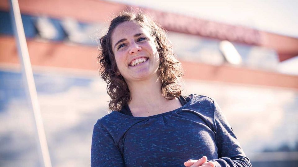
Ich konnte die Möglichkeit eines Auslandpraktikums bei der Kantonspolizei Zürich in der Schweiz nutzen.
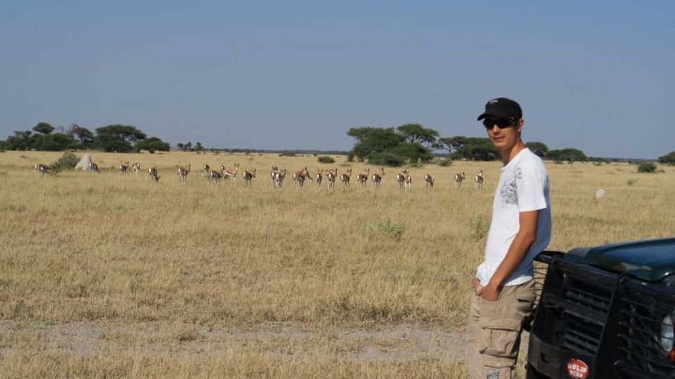
Während des 6. Semesters habe ich mein Pflichtpraktikum in Maun, Botswana, absolviert.
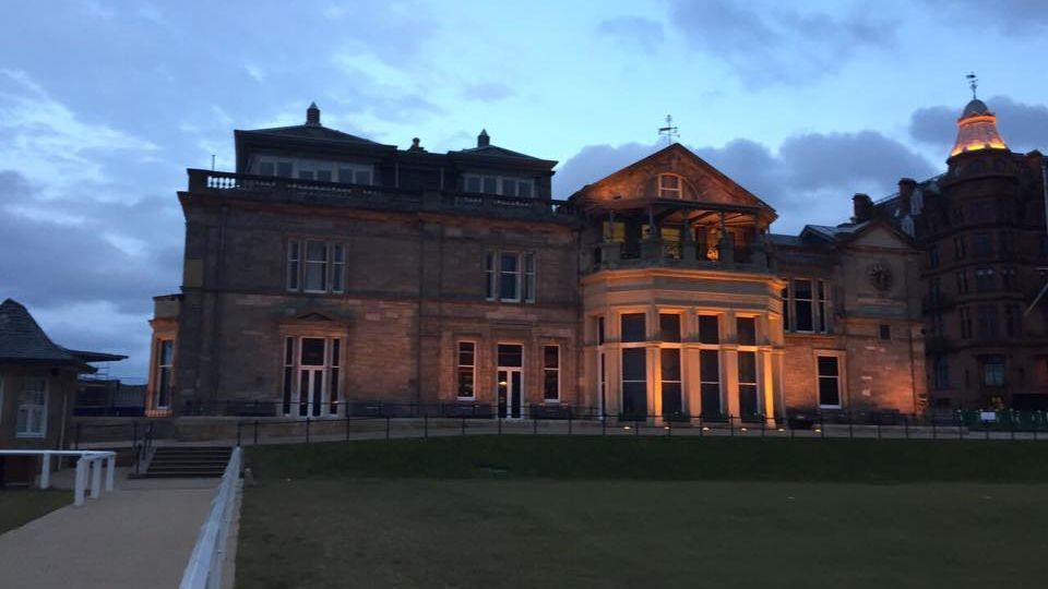
Unser zwölfwöchiges Berufspraktikum absolvierten wir am „Department of Geography“ der „University of St Andrews“ in Schottland.
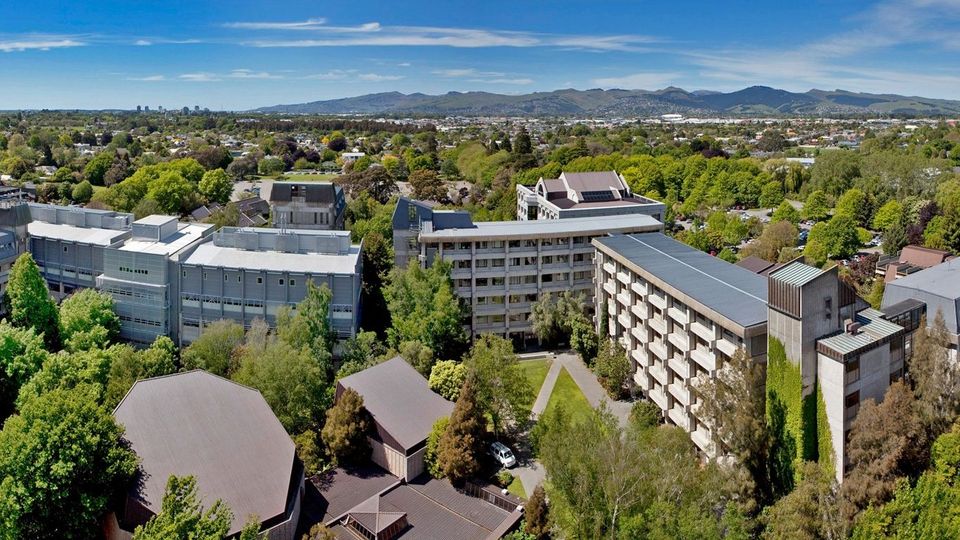
Ich absolvierte mein Berufspraktikum am „Department of Geography“ an der „University of Canterbury“ in Christchurch, Neuseeland.
Stefan Breithuber
Absolvent, arbeitet bei KELAG Energie & Wärme GmbH
Emmanuel Blaßnig
Absolvent, arbeitet im Magistrat der Landeshauptstadt Linz
Dr.-Ing. Stefan Krampe
Geschäftsführer TraffiCon
Bernhard Kosar
Absolvent, arbeitet in der Abteilung Geoinformation und Liegenschaft beim Amt der Oö. Landesregierung in Linz

Manuel Rainer hatte schon immer Interesse an IT, Umwelt und Geografie, insbesondere an respektivem Raumbezug. Aufgrund seiner Leidenschaften entschied…

After achieving my BSc in Communication Engineering in Jordan, I came to FH-Kärnten in August 2018 to join the international Master’s program “Spatial…
Die Kombination der beiden Interessensgebiete Geografie und Informatik führte Anna Staber zur Studienentscheidung „Geoinformation“ an der FH Kärnten. …
My experience during the Master’s program“Spatial Information Management” at CUAS
Time flies by. One year ago, in summer 2019, I graduated from…
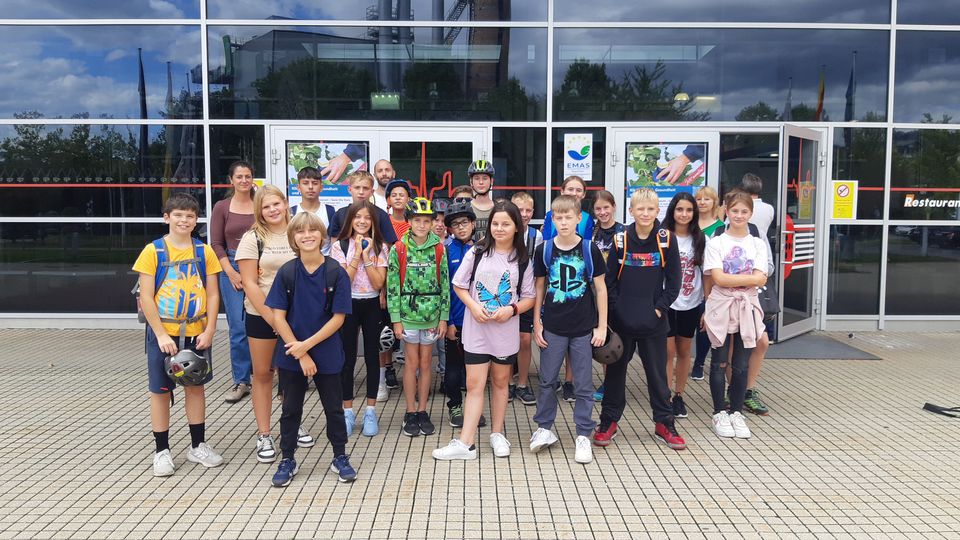
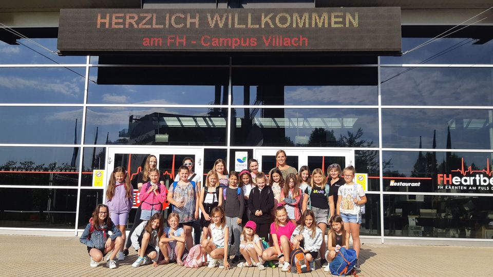
Am Mittwoch, den 20. September sowie Donnerstag, den 21. September 2023 besuchten die Klassen 3a und 2a der Sportmittelschule Lind ob Villach den…
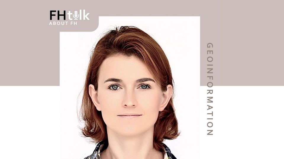
Im FH talk, moderiert von Innovationsforscherin Gloria Bottaro, spricht Daria Strelnikova über ihre Forschungsarbeit am Studiengang Geoinformation und…
Mädchen tauchen in die spannende Welt der Technik ein“ – das ist das Motto der jährlich stattfindenden „Girls‘ Days“ an der FH Kärnten in den…
Spricht man mit Lukas Wolbank, wird einem das Ausmaß der Klimaerwärmung so richtig bewusst. Weniger Niederschläge, Trockenperioden gefolgt von…
Internationale Gastprofessoren wie Dr. Michael Leitner von der Louisiana State University oder Dr. Piotr Jankowski von der San Diego State University behandeln in den Lehrveranstaltungen spannende und aktuelle Fragestellungen aus dem Bereich Geoinformation. Zudem sind wir strategischer Partner der internationalen GI Salzburg Konferenz (Kontaktperson Dr. Adrijana Car). Information zu weiteren zahlreichen Projekten und Kooperationen finden sie in unserer GI-Newsletter Reihe: Ausgabe 2019 | Ausgabe 2018 | Ausgabe 2017 | Ausgabe 2015
Die Austrian Marshall Plan Foundation vergibt jährlich Stipendien an Studierende an österreichischen und amerikanischen Hochschulen für Forschungsaufenthalte mit Schwerpunkt Technik und Naturwissenschaften in den USA und Österreich (mind. 3 Monate). Die Stipendienhöhe beträgt je nach Aufenthaltsdauer bis zu 10.000 Euro und richtet sich an Bachelor-, Master- und PhD-Studierende aus naturwissenschaftlichen Fächern.
Studierende des aktuell laufenden Studiums Geoinformation und Umwelt haben bisher sehr erfolgreich an internationalen Projekten gearbeitet.

Die Analyse von GPS Daten, die mobile Fitness-Applikationen beim Radfahren aufzeichnen, stand im Mittelpunkt des Berufspraktikums von Dariia Strelnikova. Im Rahmen eines Marshallplan Stipendiums erhielt sie die Möglichkeit zu einem Forschungsaufenthalt in den Vereinigten Staaten. Gemeinsam mit einem Team der Universität Florida wurden die Ergebnisse über raumzeitliche Muster während der Aktivität am Fahrrad gesammelt um die Radweginfrastruktur zu verbessern.

Mein Berufspraktikum im 6. Semester des Bachelorstudiengangs „Geoinformation und Umwelttechnologien“ habe ich von Februar bis Anfang Juni 2015 in den USA, in Baton Rouge, an der Louisiana State University (LSU) am Department für Geologie und Anthropologie absolviert. Mein Betreuer Dr. Michael Leitner ist dort als „Full-Time“ Professor in der Lehre und Forschung tätig und ermöglichte mir somit diesen großartigen Auslandsaufenthalt.
Das Ziel meiner Forschungsarbeit war es die drei wichtigsten statistischen Kriminalitätsvorhersagemethoden Hot Spot Analysen, Near Repeat Analysen und Risk Terrain Modeling miteinander zu vergleichen. Dabei wurden die Vor- und Nachteile der drei Analysemethoden aufgezeigt, um in weiterer Folge die passende Methode für die Stadtpolizei Wels auswählen zu können. Neben meinem Praktikum an der LSU hatte ich auch die Möglichkeit sehr viele neue und nützliche Kontakte zu knüpfen und Teile der Vereinigten Staaten kennenzulernen. Jedem dem die Möglichkeit für solch ein Praktikum geboten wird sollte die Chance im Ausland arbeiten oder studieren zu können auf jeden Fall nutzen.

As a student of the MSc program „Spatial Information Management“ (SIM), supported by the CUAS’ International Relation Office (IRO) and the Austrian Marshall Plan Foundation I had the opportunity to visit the University of New Mexico (UNM) in Albuquerque, New Mexico, U.S.A. My Marshall Plan grant resulted not only from a successful application but also from the years long cooperation between Dr. Gernot Paulus (SIM@CUAS) and Dr. Christopher D. Lippitt from the Department of Geography and Environmental Studies at UNM, both of whom supervised my thesis research.
During my stay, I worked on the quantitative comparison of nadir and oblique images, which is a part of my master thesis on the development of a multi-temporal phenological 3D model of vine. I benefited greatly from Dr. Lippitt’s extensive knowledge and experience, especially regarding remote sensing, while solving supposedly difficult problems related to image processing. Together with other incoming students I received a very warm welcome at the Department. We were introduced to all staff and had a tour of the campus and the city. I enjoyed everybody’s openness, prompt and easy communication. Aside from intense work on my project, I managed to do some sightseeing, mostly following the invitations from my colleagues. For example, I visited the Kasha-Katuwe Tent Rocks National Monument on the Pajarito Plateau, the inactive „Three Sisters“ volcanoes and the national museum of nuclear science & history. Given the high competence and experience of the staff, the friendly and respectful treatment of students, the campus amenities and the discourse and excursion offers, I would warmly recommend this research stay at the UNM in New Mexico to every student! Personally, I am exploring possibilities to return to the UNM to earn a doctoral degree.

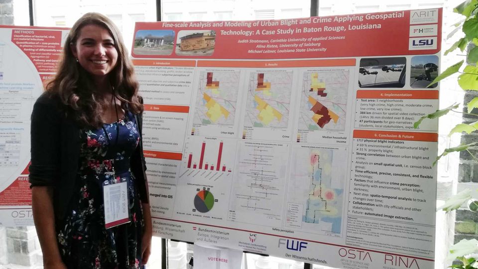
Digitale Kriminalitätsanalyse: Wie moderne Geoinformationstechnologien dabei helfen, mögliche Ursachen für das Auftreten und die räumliche Verteilung von Verbrechen besser zu verstehen.
Im Rahmen eines interdisziplinären Forschungsprojektes untersucht ein internationales ForscherInnenteam des Departments of Geography & Anthropology der Louisiana State University in Baton Rouge (USA) und des Studiengangs Spatial Information Management an der FH Kärnten (Campus Villach) mit innovativen Geoinformationstechnologien mögliche Zusammenhänge zwischen der Verwahrlosung von Stadtteilen (engl.: „Urban Blight“) und dem Auftreten von Kriminalität. Die Untersuchungsgebiete liegen im Süden der USA in Baton Rouge (Louisiana). Das Team besteht aus Michael Leitner (Professor am Dept. of Geography & Anthropology an der Louisiana State University in Baton Rouge und internationaler Experte im Bereich der räumlichen Kriminalitätsanalyse); Judith Stratmann (Masterstudentin am Studiengang Spatial Information Management an der FH Kärnten), Alina Ristea (Doktoratsstudentin am Doktoratskolleg GIScience-Geoinformatics an der Universität Salzburg) und Gernot Paulus (Professor für Geoinformation an der FH Kärnten). Ziel dieses Projekts ist es, neue interdisziplinäre Forschungsmethoden wie Spatial Video Technology und Geo-Narratives anzuwenden, um den städtischen Verfall und den Zusammenhang mit Kriminalitätsraten und Kriminalitätswahrnehmung auf der Mikroebene von „Neighborhoods“ in Baton Rouge in Louisiana (USA) zu untersuchen.
Die beiden Karten in Abbildung 1 und 2 zeigen erste Ergebnisse dieser aktuell in Baton Rouge laufenden Studie; einerseits die Verteilungsdichte für Indikatoren des städtischen Verfalls (Abb.1) und andererseits der Kriminalität (Abb.2) in den Nachbarschaften Fairfields und Mid City in Baton Rouge. Die Projektergebnisse wurden im Rahmen einer wissenschaftlichen Poster-Präsentation auf dem GI_Forum 2019 vorgestell
After achieving my BSc in Communication Engineering in Jordan, I came to FH-Kärnten in August 2018 to join the international Master’s program “Spatial Information Management”. Being in this international space paved the way for a great experience. It was a delight to learn, integrate and build relationships with international communities especially in the very nice city of Villach.
I have learnt the key principles of GIS science and I was able to put my gained knowledge to work when I was granted the Marshallplan Scholarship to do my thesis “Comparison of Convolutional Neural Network Architectures for water fowl detection and classification” at the University of New Mexico, USA, from March to July 2020.
In September 2021, I joined SIENA Research Group as a junior researcher and since that time, I have been involved in projects that utilize Machine Learning and Artificial Intelligence in spatial and environmental applications. For example, I was involved in developing pipelines for automated bird detection from areal imagery, building an extensive dataset for building footprint from satellite images, developing automatic boats tracking system based on image processing, smart-floor analysis and visualization system, automatic insect recognition, and many projects more.
If I have learnt one thing here: it’s the fact that “Geo is everywhere and in everything” and gaining knowledge about how to best utilize such treasure opens the way to endless development and achievement possibilities.
It has been such a gratifying experience working on my research in the Physics/Astronomy and Interdisciplinary Science (PAIS) Department at the University of New Mexico (UNM). As Earth and Climate Change was the subject of my thesis, the Geography Department was very helpful to me as well. My host supervisor, Dr. Christopher Lippitt specifically challenges his staff to go beyond their normal comfort levels. During my time there, I have worked closely with Dr. Lippitt, who provided me with the resources and freedom to craft research projects aligned to my interests in answering the big questions like "where is this research going?", and "what else is out there worth a research effort?" I've been consistently pushed and motivated to come up with fresh research concepts.
I think this has given me the ideal environment to develop into a creative, informed, and autonomous researcher. The lab was equipped with everything I needed to conduct the experiments and collect all the empirical data I required for my research. Its atmosphere is friendly, approachable, and the instructors, students, and staff were very helpful and supportive.
Life in Albuquerque is affordable, and locals are always open to newcomers, especially students. Exploring its neighborhoods with locals is a great way to learn about its history and culture but also avoid crime-prone areas. The state of New Mexico offers a wide range of things to do and places to explore and enjoy. If you are an outdoor person, I strongly recommend applying for this position and seeing how magnificent nature there is.
Home Institution: Carinthia University of Applied Sciences, Villach, Austria
Host Institution: University of New Mexico, Albuquerque, New Mexico, USA

My proposal on “Application of Spatial Exploratory Global Uncertainty-Sensitivity Analysis for Flood Protection Scenarios” has been accepted from Marshall Plan Scholarship, so that my journey to Austria began on the 1st of June! I was pretty sure that it would be a rewarding summer in terms of both research and fun, and neither CUAS nor Villach falsified me.
I am currently a geography PhD student in a joint doctoral program between San Diego State University and University of California, Santa Barbara. I have been studying my PhD since 2013 and my major subject area is Geographic Information Science. Specifically, I am a research assistant in a National Research Funded project called “A Spatiotemporal Approach to Sensitivity Analysis in Human Environment Systems Models”. Align with this project; my main research area is uncertainty and sensitivity analysis (U-SA) for spatially explicitly models. Therefore, my proposed study in CUAS is focused on an environmental model, flood damage estimation, considering the importance of the model output and how effective it is in decision making process. Eco-hydrological modeling of flood damage assessment often employs spatially explicit models, which are prone to uncertainty in their input and output data. A modeling approach, which quantifies both uncertainty and sensitivity, is a mandatory step to increase the quality of decision making in spatially explicit models. This research on spatially-explicit models, aims to provide an effective tool for assessment of the quality in output and therefore leading an optimization for the land suitability and resource allocation problems. Considering the environmental conditions in Austria, this makes a suitable candidate region to implement the proposed research methodology.
During my stay in Villach, the technical meetings and discussing that I made with the faculty helped me to form my model and understand the existing conventional methods applied for flood damage estimation. Especially, the help and guidance of Dr. Gernot Paulus has a paramount importance in my research. Moreover, I also had chance to deal with another research subject with Christopher Erlacher which is quite parallel to my PhD subject interest and has very fruitful results. Therefore, these three months period help me to deal two different research problems with the generous support of CUAS faculty.
Besides involving in research, I was also happy to take the advantage of being in the center of Eastern Europe. Especially, being able to travel three countries in a day without having a jetlag was very enjoyable. I made short trips to Udine, Graz, and Salzburg since I enjoy the history and architecture in a city a lot. Moreover, I visited Ljubljana and Lake Bled in Slovenia for my birthday. Although I was alone, the beauty of the nature and foods cheered me up! In this summer, the most different experience in Villach was Kirchtag for me. It was a traditional festival where people eat special food and dance in their traditional clothes. I had also chance of trying one dress, thanks to my roommate. Finally, I finished my summer time in Budapest and Vienna, which are the best places to farewell the Austria and Europe.
I am grateful for my unforgettable memories in Austria, especially to the people that I met at FH and my roommates who helped me to survive and ease my life in Villach. I am pretty sure that those people will turn to lifelong friends.

My three months at FH Kaernten have been both productive and enjoyable. I was able to use this time to create a simulation model of the potential trajectories of wolf recolonization of Austria from the ground up. It was a tremendous learning experience for me and it also yielded some interesting outputs and results. In addition, was able to find time to explore the region, cycling over a thousand km in the nearby countryside and travelling further afield during weekends (with trips to Innsbruck, Vienna, Italy, Slovenia, and the UK). I found the department in general, and Dr. Paulus in particular, to be extremely supportive and helpful in pursuing this new research, and I’m very thankful to the Marshallplan foundation for making it all possible.

Based on the characteristics of ALTA platform and the need of three dimensional modeling, a method of 3D building or architecture modeling using the aerial images from ALTA platform has been assessed empirically. Firstly, we have captured oblique and vertical images of any building or architecture from the camera of ALTA plat-form through several missions in Villach, Carinthia, Austria. Secondly, several-angle and different altitude images including vertical images and oblique images captured by the ALTA platform were utilized for the detail measure of building dense point cloud, surface and texture extraction in 3D model reconstruction using different photogrammetric solutions.
These reconstructed 3D models are also visualized online taking 3D point clouds of them on potree-based 3D web visualization tool. It is demonstrated from the mission result that ALTA platform for low-altitude aerial photogrammetry can be used in the construction of 3D building production, fine modeling and visualization. The 3D point cloud reconstruction from 2D aerial images of the pilgrimage church of Maria Siebenbrünn is shown in figure 1.
Experience
It was really a great experience to work this kind of pragmatic research work and also great to have support from Austrian Marshall Plan Foundation during the accomplishment of this research work in Austria. My lead project supervisor Dr. Gernot Paulus, Professor, Department of Geoinformation and Environmental Technologies, Carinthia University of Applied Sciences (CUAS), Villach, Austria gave me encouragement to complete this work and participated actively and dynamically during the data acquisition of my work.
My co-lead supervisor of this project Dr. Naphtali David Rishe, Professor, School of Computing and Information Sciences (SCIS), Florida International University (FIU), Miami, FL, USA initiated this collaboration research work and monitored the progress of this work. Daniel SIchler, MSc student from CUAS gave me the support and company during data acquisition. The administrative and technical staff of the Geoinformation and Environmental Technologies department of CUAS provided me any required support during my stay.
Finally, I actually travelled to nearby locations of Villach, Austria for the first time and also I enjoyed the Marshall plan excursion for one day at the end of our stay to Italy and Slovenia. All in all, it was a great experience!

Since May, I have been a guest researcher at CUAS as a recipient of the Austrian Marshall Plan Foundation scholarship. The 70-year-old foundation has the mission of fostering collaborative learning between the United States of America and Austria. I believe it is more important now than ever to maintain these scholastic bonds and knowledge bases through a cross-cultural lens, and I am happy to be a part of that endeavor. Under the guidance of Dr. Gernot Paulus, I have worked for the last three months to develop a project that utilizes high-tech drone imagery to model hydrologic phenomena, hopefully with implications in the realm of resilience and human equity. Our semi-regular talks have opened up new ways of thinking and tackling problems.
The learning opportunities at CUAS are numerous, with a colloquium series, an open-format geoinformatics lab, and excursions around Carinthia and greater Austria. The university also funded my attendance at the GI-Forum Conference in Salzburg, where I was able to meet fascinating geographers and learn about the array of research that dominates our robust field. Of course, my time has not been entirely research and school – I have been able to travel (this is my first time to Europe) and experience the rich heritage of Carinthia through the Kirchtag Festival, walking tours, hikes, bike rides, and near-daily visits to one of the many lakes within walking distance. And while Austria provided little respite from the Chihuahuan Desert summer heat in my home state of New Mexico, I have been able to marvel at the stunning beauty of the land here. I will surely cherish this time for years.

My research group at the University of Florida has close ties with the Geoinformation Program at CUAS. Many CUAS students have visited my lab in Fort Lauderdale throughout the last few years to work on interesting projects involving novel data sources such as Twitter or Strava. This year, however, we decided to change the direction of visits and I applied for the Marshall Plan Scholarship to conduct part of my research in Austria. This program supports academic exchange between Austrian and U.S. universities and I am more than happy to have been one of the 2018 awardees and to have spent an enjoyable three months in Villach.
I have a diverse background in geospatial sciences, and lately, my research interest turned towards understanding user behavior in different online communities. My stay at CUAS was organized around the topic of “Identification of activity patterns for individual users across multiple VGI and social media platforms”. In the era of “big data” there are endless potential data sources on the internet that can be put into use and help us answer a number of research questions. You can think of social media services such as Twitter, Instagram, Flickr, Snapchat, or even popular games like Pokémon Go. These services all have a spatial dimension, which makes them particularly exciting from a geospatial point of view. This is a relatively new and exciting research area that involves diving into previously unexplored territories. On the other hand, this is also one of its biggest challenges. I am currently in the last phase of finishing my PhD.
In addition to the challenges originating from my research area, the process of getting a PhD also comes with a lot of stress. One needs to find time to do research, publish papers, present at conferences on top of fulfilling all the requirements that are required for the degree. I found that my visit at CUAS was exactly what I needed to tackle these. Carinthia has a great many things to offer that helped me relax between long hours of work and to start every day refreshed. I enjoyed every bit of my stay. I will never forget my biking trips around Faaker See and Ossiacher See, the random visits of cafés in Velden, or my morning commute to campus along the Drava river. While living in the middle of a major U.S. metropolitan area also has its perks, I believe that productivity levels can benefit from a change in our environment for a short while. The peace and quiet in Villach and the beautiful sight of the Alps certainly increased mine.
All in all, the Marshall Plan Scholarship is an excellent opportunity for students, and I encourage you to apply. Gaining experience in a foreign country, working on interesting projects can boost your future career. You will learn useful skills, make meaningful connections that are all essential for your development. And above all, you will make unforgettable memories.

Not many people think of Austria as a place to study monkeys but that is exactly what we did. Over the summer in collaboration with Carinthia University of Applied Science and San Diego State University with support from the Marshall Plan Foundation, we investigated the ability of drones equipped with thermal sensors to detect monkeys in forested areas.
To begin our research, we started by testing the ability of sensors to detect large primates in an open area (people standing out in a field) and then slowly refined the process until we were able to transfer our process to fly over Abenteuer Affenberg, where we conducted flights over the park with the hope of being able to detect the Japanese macaques living there. One of the concerns we had going into this final phase of testing was that the monkeys would be alarmed by the drone fly overhead, which would appear similar to one of their main predators. Luckily, the monkeys appeared to not be concerned at all with the drone buzzing overhead. Hence, we were able to conduct our flights without worry that we were causing the monkeys distress and were able to collect some interesting data for analysis. While the processing of the data is still ongoing, the preliminary results are positive and will hopefully lead to a more streamlined process to gather population data of primates.
We expect our approach to be beneficial to both the researchers and the wildlife as it is less invasive for the animals and more cost and time effective for the researchers. Once the data collected has been fully explored and we have determined the applicability of the process, the next hopeful progression of this research is to transfer what we learned in to the forests in the Fanjingshan National Nature Reserve in China to help conservationists monitor and protect the endangered Golden snub-nosed monkey. We would like to thank the CEO of „Abenteuer Affenberg“, Svenja Gaubatz and the scientific director Dr. Lena Pflüger for their great support.
FH-Prof. Dipl.-Ing. Dr. techn.
Christian MenardFH-Prof. Dipl.-Ing. Dr.
Gerald GruberMag.a
Michaela Gollner, MSc.Mag.a
Sandra Filipic-KlinarFH-Prof. DI (FH) Dr. techn.
Markus ProsseggerFH-Prof. Dr.-Ing.
Karl-Heinrich AndersFH-Prof.in Dipl.-Ing. Dr.in techn.
Adrijana CarFH-Prof. Mag. Dr.
Gernot Paulus, MSc. MASDipl.-Ing.
Daniela Krainer, BScIng.
Peter GrabnerDI (FH)
Nikolaus OrtnerMag. Dr.
Lukas BirsakMag. Dr.
Ralf BlahaIng.
Hubert DobrounigIng. Dipl.-Wirtsch.-Ing. (FH)
Manuel ErberMag. Dr.
Florian FischmeisterDipl.-Ing. (FH) Dipl.-Ing.
Markus HaringDI
Claudia Piechl, MScDr.
Ingo SimonisDr. med.
Martin StultschnigIng.
Michaela Wartbichler
Klagenfurt vereint Lebensfreude, Natur und Kultur. Die knapp über 100.000 Einwohner-Stadt am Wörthersee ist ein Erholungsgebiet, das jeden Wunsch erfüllt. Slowenien und Italien sind nicht weit entfernt, die Berge sind greifbar nahe. Lebendig ist auch die Klagenfurter Kulturszene mit Clubs, Bühnen und Museen. Der Alte Platz mit vielen Geschäften, Restaurants und Cafés ist er der Mittelpunkt des städtischen Lebens. Der idyllische Lendkanal verbindet die Stadt mit dem See und ist wie das Kreuzbergl ein beliebtes Ziel für Hobbysportler und Naturliebhaber.
Der Campus in der Primoschgasse verfügt über perfekte Verkehrsanbindungen – eine eigene Buslinie hält direkt vor der FH am Südring. Der Ausblick von der Dachterrasse auf das um Klagenfurt liegende Bergpanorama bietet den perfekten Raum für erholsame Pausen.
Erkunden Sie den Campus Klagenfurt–Primoschgasse bei einer 360° Tour.
von Westen kommend (von A10, A11) entlang der Südautobahn A2:
Abfahrt Klagenfurt/Wörthersee (Minimundus), entlang Südring etwa 7 km, bei Kreuzung Südring/Gerberweg (BP-Tankstelle) stadteinwärts abbiegen (links), nach 150 m rechts abbiegen zur FH Kärnten - Standort Klagenfurt, Primoschgasse 10.
von Osten kommend entlang der Südautobahn A2:
Abfahrt Klagenfurt-Ost, stadteinwärts abbiegen (links), Richtung Klagenfurt-Zentrum nach 1 km auf die Völkermarkterstraße (rechts) nach etwa 2.5 km Kreuzung in den Südring links abbiegen (Kika), bei Kreuzung Südring/Gerberweg (BP-Tankstelle) stadteinwärts abbiegen (rechts), nach 150 m rechts abbiegen zur FH Kärnten - Standort Klagenfurt, Primoschgasse 10.
von Süden kommend entlang der Rosentalerstrasse B91:
bei Kreuzung Rosentalerstrasse/Südring (PSK) in den Südring rechts abbiegen, entlang Südring etwa 2.5km. bei Kreuzung Südring/Gerberweg (BP-Tankstelle) stadteinwärts abbiegen (links), nach 150 m rechts abbiegen zur FH Kärnten - Standort Klagenfurt, Primoschgasse 10.
von Norden kommend entlang der St. Veiterstrasse B83:
stadteinwärts bis Kreuzung St.Veiterstrasse/St.Veiterring, links abbiegen, den St. Veiterring folgend in den Völkermarkterring (rechts) Richtung Süden, Verlängerung Völkermarkterring in die Lastenstraße bis nach Bahnunterführung (etwa 800m), Verlängerung Lastenstraße in den Gerberweg, nach etwa 750m links abbiegen zur FH Kärnten - Standort Klagenfurt, Primoschgasse 10.
Klagenfurt Hauptbahnhof, Fußweg bis Südpark entlang Bahnstraße (Richtung Osten), Fußweg entlang Gerberweg bis Primoschgasse zur FH Kärnten - Standort Klagenfurt, Primoschgasse 10 (Richtung Süden), Dauer ab Hauptbahnhof etwa 20 min.
Flughafen Klagenfurt, mit Taxi zur FH Kärnten - Standort Klagenfurt, Primoschgasse 10 (Dauer etwa 20 min), oder mit Stadtwerke Autobus bis zum Heiligengeistplatz, umsteigen zur Linie 40, 41, 42, 70 oder 71. Dauer ab Flughafen etwa 50 min.

Primoschgasse 8–10
9020 Klagenfurt, Austria
+43 5 90500 3101
engineering-it[at]fh-kaernten[dot]at
+43 5 90500 3301
gesundheit-und-soziales[at]fh-kaernten[dot]at
Erkunden Sie den Campus Klagenfurt–Primoschgasse bei einer 360° Tour.


Die Region Villach verbindet Tradition, Weltoffenheit und Lebensqualität mit den Vorzügen eines innovativen Wirtschaftsstandortes. Villach, mit etwa 60.000 Einwohnern eine Kleinstadt, ist ein internationaler Hochtechnologiestandort mit wegweisenden Kooperationen zwischen Wissenschaft und Industrie und entwickelt sich auch zunehmend zu einer Gründerstadt.
Direkt am Schnittpunkt dreier Kulturen gelegen ist Villach, am Drau-Fluss gelegen, ein wichtiger Verkehrsknotenpunkt im Alpen-Adria-Raum. Diese spezielle geographische Lage und die wunderschöne Landschaft rund um Villach und im Bundesland Kärnten machen die Region seit Generationen, weiter über die Grenzen hinaus, zu einer beliebten Urlaubsdestination. Die Trinkwasserqualität der Seen und die besonders saubere Luft machen Villach und seine Umgebung zu einem Umweltparadies.
Neben den geographischen Pluspunkten überzeugt Österreich auch im weltweiten Vergleich führend mit dem Sozial- und Gesundheitssystem und gilt als besonders sicheres, wohlhabendes und lebenswertes Land.
Trotz des überdurchschnittlichen Wohlstandes und den umfassenden staatlichen Sozialleistungen schneidet Villach im Kostenvergleich mit vielen internationalen Destinationen preiswert ab. Der “Kleinstadtbonus” kommt hier voll zum Tragen und ermöglicht einen erschwinglichen Alltag.
Erkunden Sie den Campus Villach bei einer 360° Tour
Erkunden Sie die Science & Energy Labs – T10 bei einem virtuellen Rundgang
Autobahnabfahrt Wernberg, dann auf der B 83 ca. 2 km Richtung Villach, nach dem Ortsschild Villach führt die B83 unter der Autobahn A2 durch, und dann gleich rechts die erste Abfahrt Richtung MAGDALENEN SEE. Der Beschilderung Magdalenen See folgend, führt die Straße durch ein kleines Waldstück, immer der Straße nach, geht es nach einer S-Kurve vorbei am Magdalenen See (links) immer gerade aus, die Südbahn wird überquert und es geht bergauf direkt ins Zentrum von St. Magdalen. Auf der Kuppe rechts abbiegen, die Straße bergab, es ist bereits in Richtung Süden das Gelände des Technologieparks sichtbar, Schornstein des Heizkraftwerkes, und direkt in der scharfen Rechtskurve links abbiegen auf das Gelände des Technologieparks.
Autobahnabfahrt Villach/Ossiacher See, dann ca. 2 km Richtung Villach, rechts kommt der Gasthof Seehof, links liegt der Vassacher See, weiter auf der B33 links Richtung Osten, Wernberg, Klagenfurt, immer der B33 nach, nach ca. 4 km rechts abbiegen Richtung Magdalenen See. Die Straße führt durch ein kleines Waldstück, immer der Straße nach, geht es nach einer S-Kurve vorbei am Magdalenen See (links) immer gerade aus, die Südbahn wird überquert und es geht bergauf direkt ins Zentrum von St.Magdalen. Auf der Kuppe rechts abbiegen, die Straße bergab, es ist bereits in Richtung Süden das Gelände des Technologieparks sichtbar, Schornstein des Heizkraftwerkes, und direkt in der scharfen Rechtskurve links abbiegen auf das Gelände des Technologieparks.
Das Busunternehmen Dr. Richard fährt ca. alle 15 min. von der Stadt zum Campus. Die Fahrpläne sind mit den Fahrplänen der ÖBB abgestimmt.

Europastraße 4
9524 Villach, Austria
+43 5 90500 7700
villach[at]fh-kaernten[dot]at
Erkunden Sie den Campus Villach bei einer 360° Tour.


